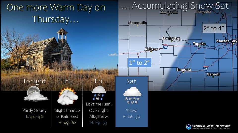
Thursday will be the last warm day across most of the area. A cold front will move through the area Thursday night as an upper level storm system approaches the region Friday through Saturday.
Most areas will see rain developing Friday morning with the rain mixing with and changing to snow across north central KS Friday afternoon. The rain will mix with freezing rain and snow across east central and northeast KS Friday night, and should change all to snow on Saturday.
At this time the greatest snow accumulation of 2 to 4 inches will be the eastern counties on Saturday. Highs by Saturday will only reach the mid to upper 20s.
The Junction City - Manhattan area is in the 1-2 inch range snow forecast.