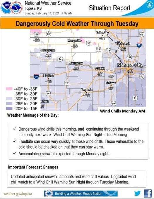
The National Weather Service said Sunday that an additional one to four inches of snow are expected across the forecast area into Monday morning. Wind chills remained between fifteen and twenty-five degrees below zero Sunday afternoon. The potential increased for Sunday night into Tuesday for dangerous wind chills twenty-five to thirty-five degrees below zero.
THE NATIONAL WEATHER SERVICE SAID A WINTER WEATHER ADVISORY REMAINS IN EFFECT UNTIL 6 AM MONDAY. A WIND CHILL WARNING REMAINS IN EFFECT UNTIL NOON CST TUESDAY. For the Wind Chill Warning dangerously cold wind chills are expected. Wind chills as low as 35 below zero are possible.
For the Winter Weather Advisory, there is the potential of snow. Additional snow accumulations of 1 to 4 inches, with 2 to 4 inches are possible south of the Kansas Turnpike. Portions of central, east central, north central and northeast Kansas are included in the weather forecast area.
Plan on slippery road conditions. The hazardous conditions could impact the evening commute. The dangerously cold wind chills could cause frostbite on exposed skin in as little as 10 minutes.