Geary County Emergency Management has released a report from the National Weather Service on the potential for thunderstorms.
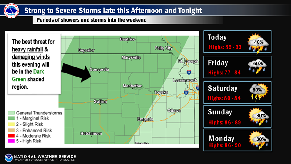
A surface cold front will move into the area late this afternoon and tonight. Strong to severe thunderstorms will develop along the front across north central KS late this afternoon and evening then slowly push east across much of the area through the night. The primary hazard from any severe thunderstorm will be damaging wind gusts.
Given the slow motion of the line of storms and high rainfall rates, there may be some isolated flooding Saturday night across the region. The thunderstorm chances will continue into the weekend with perhaps another chance for strong to severe thunderstorms on Saturday as an upper level disturbance approaches the region. There will be smaller chances for thunderstorms Sunday into the workweek.